Laser Airborne Depth Sounder (LADS)
 |
| Aircraft | de Havilland Dash 8-200 |
|---|---|
| Crew | 2 pilots (civilian), 2 survey systems operators (Navy) |
| Aircraft take off weight | 18 tonnes |
| Aircraft transit speed | up to 300 knots |
| Survey speed | 140 to 200 knots (72 to 103 metres per second) |
| Operating height | 366 to 914 metres above the sea surface (1200 to 3000 feet) |
| Survey Measurement Range |
|
| Sounding pattern | 114 to 598 metres wide |
| Navigation | Wide Area Global Positioning System |
| Sortie duration | 7 hours |
| Personnel (Navy) |
|
| Personnel (Contract) | supported by Fugro LADS Corporation and subcontractors |
| Home Base | Cairns, deployable for periods of up to 10 weeks throughout Australia and Australia's Area of Charting responsibility. |
| Last Flight | 6 November 2019 |
| News Articles | Defence News |
While relatively unknown, the Royal Australian Navy used to employ an extremely capable and effective airborne survey asset. The Navy’s Laser Airborne Depth Sounder (LADS) Flight formed in 1992 after more than 20 years of research and development.
The first LADS aircraft used was a Fokker F27 built in 1976 and operated by East-West Airlines before being modified to for LADS operations, with modifications including a laser bay and doors under the fuselage, additional fuel tanks, precise navigation systems, and a stabilised platform for the laser.
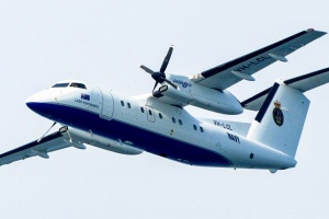
The Fokker F27 was replaced in November 2009 with a de Havilland Dash 8-202.
The Dash 8 had previously been employed by Fugro LADS Corporation (formally Tenix LADS Corporation) to conduct similar LIDAR survey activities internationally. The Royal Australian Navy was the first and one of only a few military organisations in the world to have employed airborne laser bathymetry.
The heart of the survey system was a powerful laser that determines aircraft height information above the sea surface (and ellipsoid) while producing a scan width of up to 598 metres (typically 193 metres for IHO Order 1b surveys), recording depths up to 80 metres deep in pristine waters and topographic heights up to 50 metres above sea level. Navy personnel operate the survey system from the main cabin of the aircraft. Back on the ground the data is processed prior to being sent to the Australian Hydrographic Office in Wollongong, New South Wales for incorporation into updated nautical charts.
During survey operations the LADS aircraft flew at between 1200-3000 feet (366 and 914 metres) altitude and could survey more than 60 square nautical miles per day. With more than seven hours endurance and flying a minimum of 140 sorties annually the LADS Flight was a very productive capability.
The LADS Flight was based at Cairns airport in Far North Queensland. However, it could be deployed for periods of up to ten weeks. Deployments have included Adelaide, Launceston, Mackay, Norfolk Island and Papua New Guinea. The LADS survey team consisted of eight RAN Hydrographic specialists: two officers, three senior sailors and three junior sailors.
Specialist support was provided under contract by Fugro LADS Corporation and their subcontractor Cobham Aviation Services Australia and included pilots, aircraft engineers, systems technicians and a field manager. Together, the Navy and civilian personnel formed a highly specialised team which ensured that the RAN remained at the forefront of surveying capability.
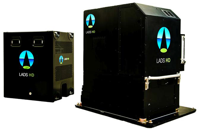
LADS HD equipment.
A number of survey projects were normally surveyed concurrently by LADS Flight, allowing the aircraft to be directed from one to another if localised weather conditions or water clarity was unsuitable. The pilots were responsible for aircraft navigation and safety, while Navy personnel were responsible for the conduct of survey operations, including selection of survey runs, directing the pilots onto each line, monitoring system performance and when necessary determining where to relocate to if conditions were not suitable in the primary area. Survey operators are able to adjust the laser and receiver settings and operating modes to ensure optimal performance of the system.
In relatively clear coastal waters LADS proved to be highly effective. Its productivity and area coverage was so good that surface units were routinely not tasked to these areas. In regions of poor water clarity LADS was a complementary capability to surface survey units. More than 26 years after the first experimental laser flew, this Australian designed system remained at the forefront of both laser based systems and hydrographic survey systems in general. In total, the LADS Flight had flown more than 3000 sorties, conducted 186 surveys and covered an area of more than 50,000 square kilometres.
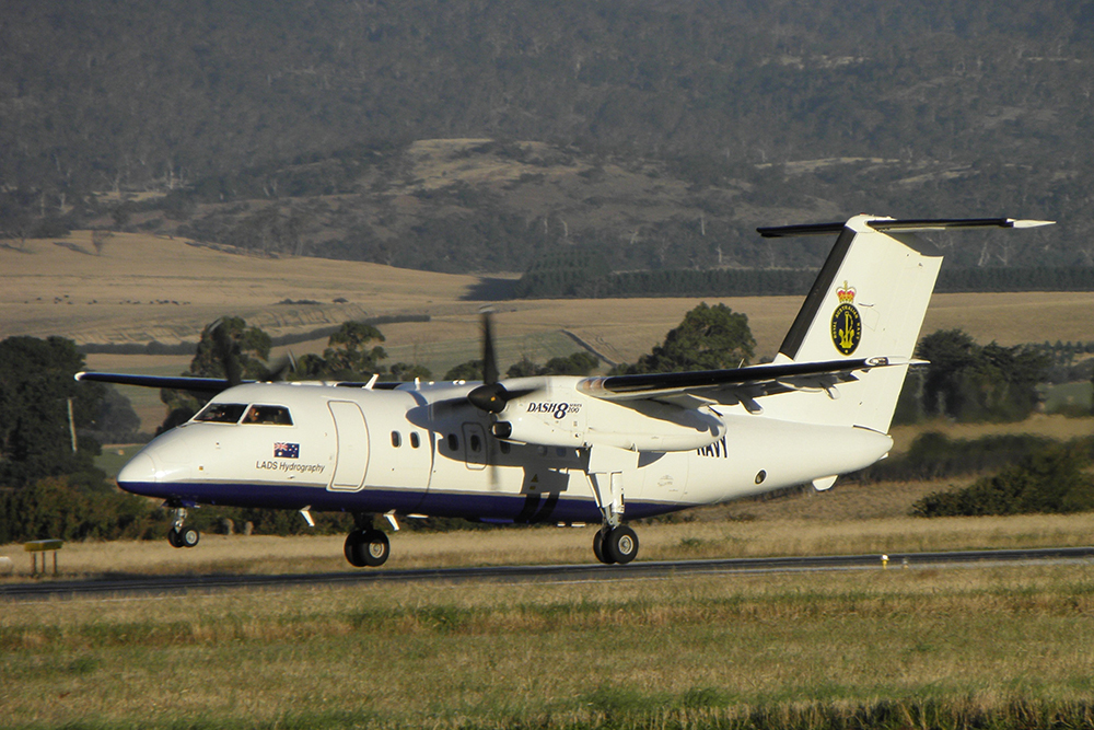
LADS Aircraft HI600.
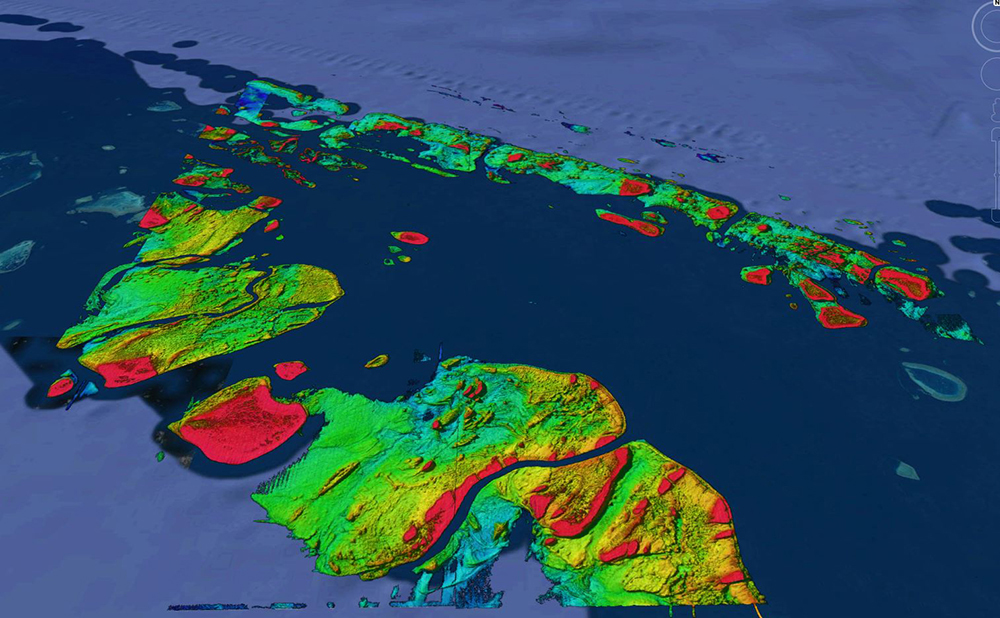
Survey Data.
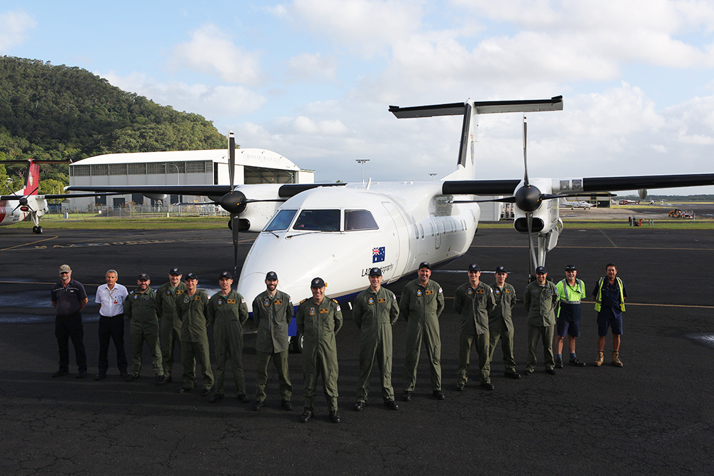
LADS Flight July 2017.
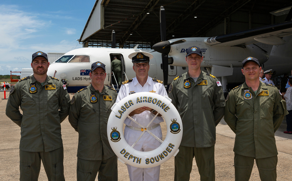
Royal Australian Navy's Laser Airborne Depth Sounder (LADS) Flight crew on completion of the LADS Flight end of service ceremony at Cairns Airport, Queensland. L-R: Petty Officer Jarrod McAnn; Chief Petty Officer Luke Heard; LADS Commanding Officer Lieutenant Commander Mark Matthews; LADS Executive Officer Lieutenant Cheyne Colley; and Leading Seaman John Krasicki.
